Ojén’s backyard
Since July 2021 Andalusia has a third National Park: the Sierra de las Nieves. During my time as the owner of Hotel La Posada del Angel in Ojén, there were always guests who wanted to take a walk in that area. We know all the trails and beautiful views on the Ojén side of the park ourselves. But what makes this area so special that it now enjoys the highest protection?
National Park
If a nature reserve receives the status of National Park, extra money will be made available to intensify the management and development of the park. And surprisingly, there is also financial scope for promoting nature-oriented recreation, information and research.
- A National Park must meet certain requirements: The area must be at least 20,000 ha in size.
- It must have a special landscape condition as well as a special plant and animal life.
- There must be opportunities to use parts for recreation.
- It may contain no or almost no cultivated land.
For the Sierra de las Nieves, almost 1.5 million euros per year will be available. In addition, more money is available for specific projects. The villages located directly in the vicinity of the National Park also benefit from this new status. More visits from nature lovers means more income.
Sierra de las Nieves, the origins
The Sierra de las Nieves is part of the Serranía de Ronda. It was created millions of years ago when the European and African tectonic plates collided. The Sierra de las Nieves is located exactly where the 2 mountain ranges meet on the west side. Folds and the sliding of earth plates over each other have created a complex system of high mountain peaks, deep ravines, gullies and rivers, gorges and caves filled with groundwater in various layers. The water from this area is also used as drinking water for residents of the surrounding municipalities. The entire mountain area is 100,000 hectares, the National Park with its 23,000 hectares is part of it.
Besides the white-grey limestone peaks (karst), there are also reddish periodite rocks. The latter have a magmatic origin and are rare on Earth. Three hills have this unique geological origin and are brownish reddish (Corona, Abanto and Plaza de Armas).
The contrasts are great. The highest mountains are the Torrecilla (1919 m) and the Peñon de los Enamorades (1775 m). But there are also underground depths such as the GESM gorge (1101m) and the Sima del Aire (-658m).
Altogether, the special and unique geological condition of this area is one of the reasons for making this park a National Park.
Flora and Fauna
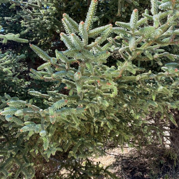

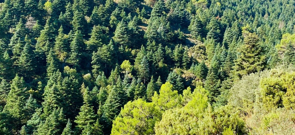
Another reason for the designation as a National Park is the flora and fauna in the area. The most famous unique flora is the Pinsapo.
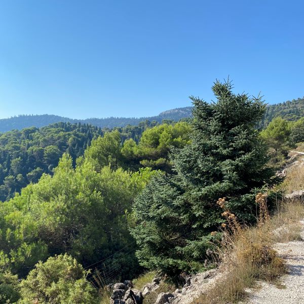
This spruce was discovered in 1838 by 2 pharmaceutical companies. It is now clear that millions of years ago, during the Ice Age, this tree was found in vast forests. Today the pinsapo is almost nowhere to be found, only in southern Spain and in the north of Morocco. In Andalusia the Pinsapo forests (pinsapares) are only found on calcareous soils in the Serranía de Ronda: in the Sierra de las Nieves, the Sierra Canucha (north-west of Ojén) and in the Sierra del Pinar (Grazalema). They also occur in the area of Los Reales de Sierra Bermeja, but then on the red periodite soils. In general, the pinsapo are located on northern slopes, protected from excessive solar radiation and desiccation. The pinsapo has been the main reason for declaring the Sierra de las Nieves a National Park.
Human and nature
In this area people have lived for centuries in perfect harmony with nature. Because of the abundant natural wealth, the breath taking landscapes, the wide variety of ecosystems and the presence of unique plants such as the pinsapo, the nature reserve was previously named Parque Natural and Reserva de Biosfera. In addition, the Sierra de las Nieves has a rich cultural, historical and ethnological legacy.
The area is named ‘de las Nieves’ due to the fact that snow can fall on the tops of the mountains in winter. This snow used to be kept in pits, which in summer was transported at night by mules to the villages for cooling. These wells can still be found in some places.
THE NEW NATIONAL PARK – WHAT CHANGED?
The National Park is larger than the Parque Natural. A number of ecologically interesting areas have been added, mainly at Istán and El Burgo. At Monda and in the north on the Ronda side there are areas that are not included because they contain private land or are hunting grounds.
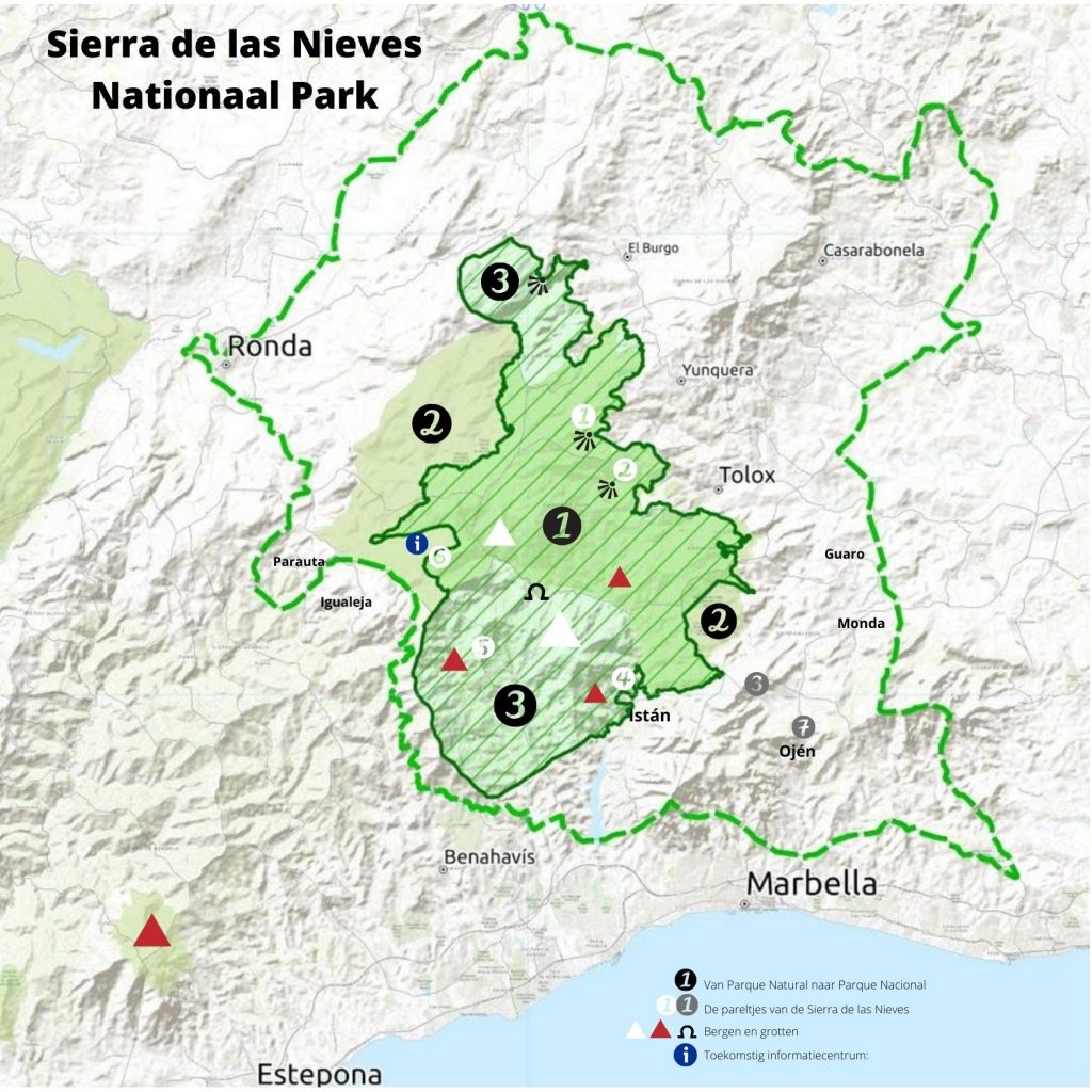
There are 3 distinct areas on the map:
1) Belonged to the Parque Natural and is now also a National Park
2) Still belongs to Parque Natural but not to the National Park
3) Did not belong to Parque Natural, but has been added to the National Park
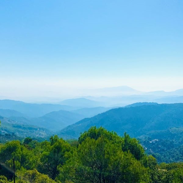
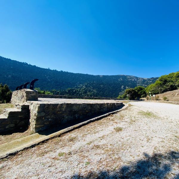
The park has several entrances. On the Ronda and Torrecilla side at the Area Recreativa Quejigales, at Istán, by the road to the Refugio de Juanar in Ojén, at Tolox, Yunquera and El Burgo.
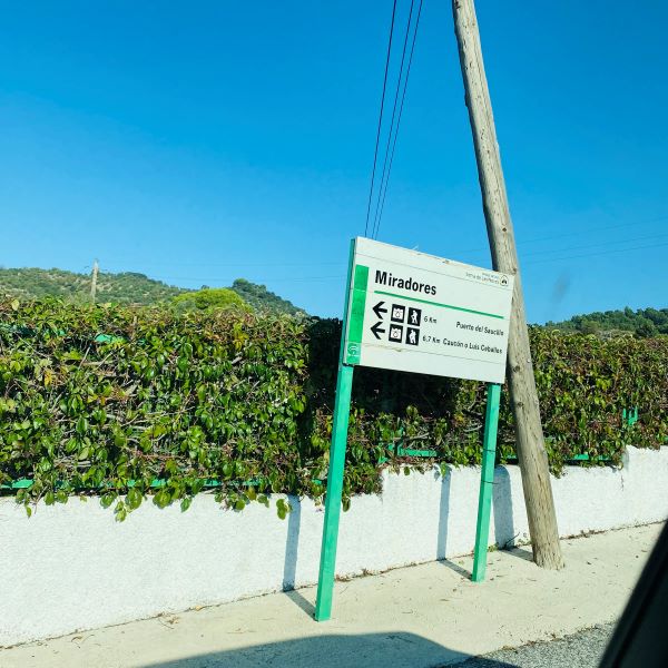
From a number of miradors you have a view of slopes full of pinsapos: Mirador del Guarda Forestal on the A-366 at El Burgo and also accessible by car in winter: Puerto Saucillo and Luis Ceballos.
What will change
With the arrival of the National Park, money will become available in the short term, especially for stimulating tourist use of the park through the realization of the points below.
- Yunquera: an office from which the management is arranged
- A visitor center in PARAUTA (zona llamada Conejeras) at the entrance of the Camino de Quejigales (also starting point for ascent of the Torrecilla), on the road between Ronda and San Pedro
- A visitor center at the entrance to Tolox
- A nature classroom for environmental education in El Burgo
- An information center in the villages belonging to the park
- Overnight places for motorhomes
The gems of the Sierra de las Nieves according to experts:
- Sendero Tajo de la Caina (1) and Sendero Saucillo (2), both circular from Yunquera
- Sendero La Pozuela (3) from Refugio de Juanar (see Especial Life, June 2021)
- Canelón de Istan (4), a walk to a waterhole for a cooling dip
- Castano Santo (5), a 1000-year-old chestnut tree with a size of 14m and 23m high
- Monumento Natura: El Pinsapo de la Escalereta (6), the oldest pinsapo of about 350-550 years, 26 m high, 5 m thick and a crown of 200 m2 (Parauta)
- And I would like to add to this: EcoReserva Ojén (7), shelter for needy wild animals, education and research.
ONE OF THE MOST INTERESTING HIKES FOR SEEING THE PINSAPO
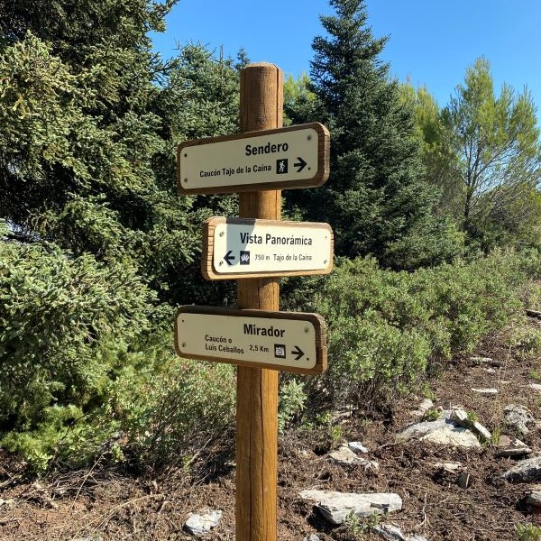
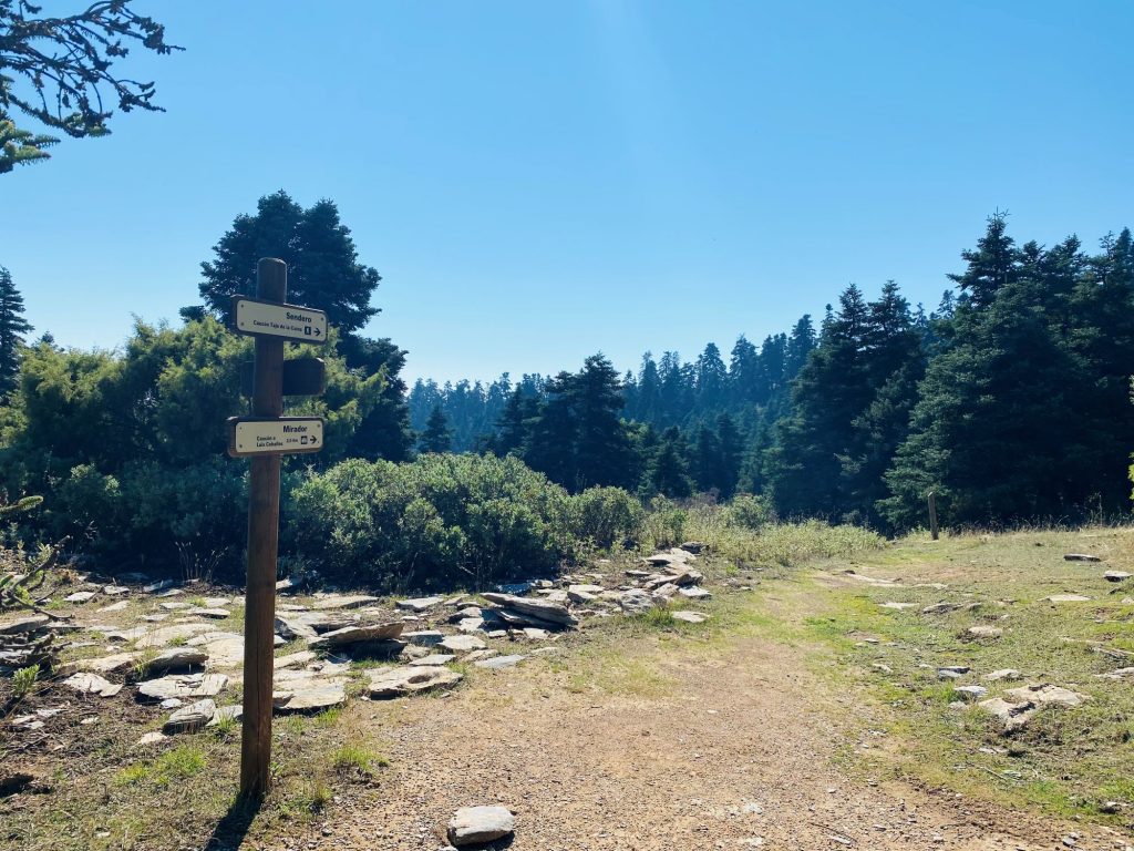
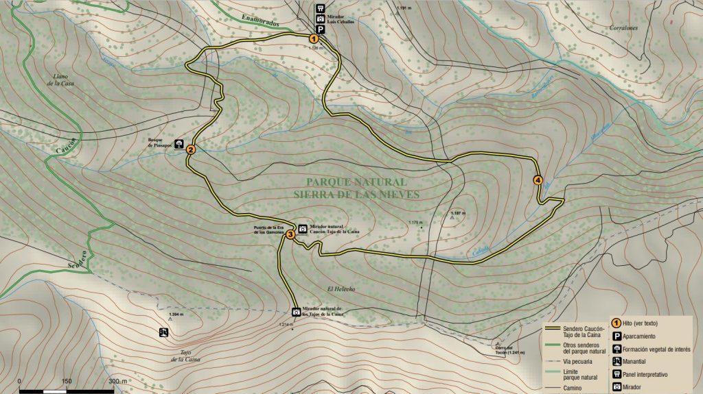
Sendero “Caucón Tajo de la Caína” (mid level, height difference 232 m)
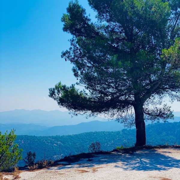
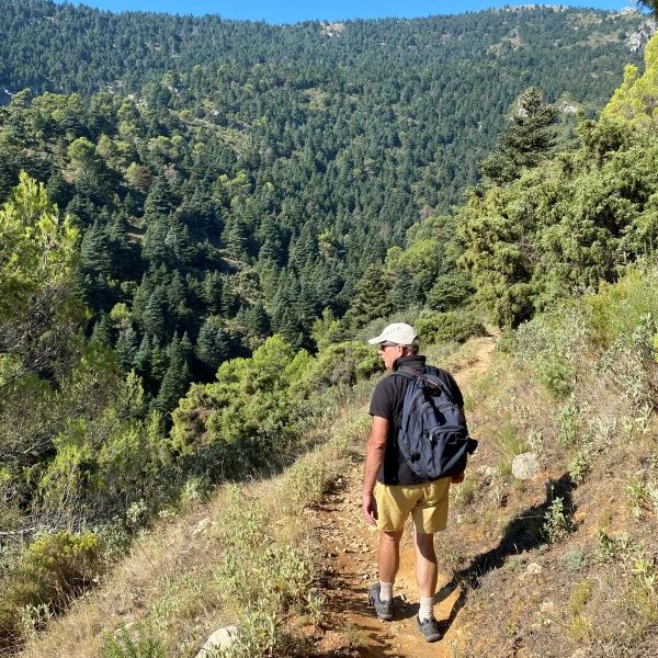
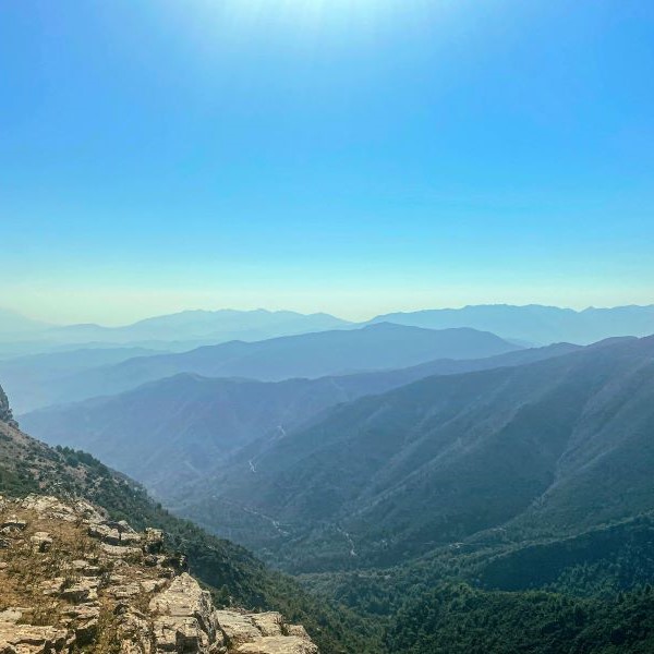
In the middle of the National Park are two circular walks of about 2 hours. These are the walks where you have the best view of the special pinsapo. We do the “Tajo de la Caína” which departs from Mirador “Luis Ceballos”.
From Yunquera we leave the A366 (direction Ronda), after the petrol station, to turn left, the Camino de Sierra de las Nieves, in the direction of the sports complex (polideportivo municipal). In summer it is not possible to drive here by car (closed April-mid October). In that case you can leave the car after 4.2 km in a small parking lot and then follow the path to the mirador. It is 2.5 km to the mirador, on an easy-to-walk path with beautiful views. Here and there you can already see a lonely pinsapo, but mainly Aleppo pines and Mediterranean scrub.
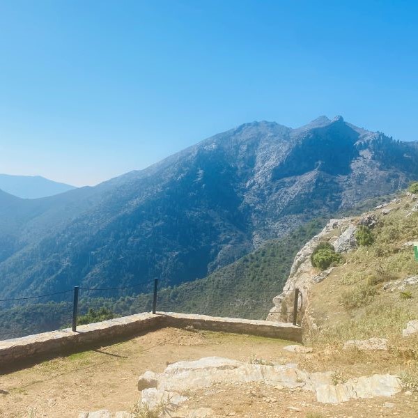
From the mirador you have a spectacular view of the enormous Pinsapo forest (2). The whole slope, as far as you can see, is filled with pinsapo. From the mirador we turn right (turn counter clockwise). Of the two paths we take the lower one. After some time we arrive in the forest. The trees are huge and offer plenty of shade, the route has occasional posts with arrows, you really can’t go wrong.
The next point we pass is a natural mirador; la Era de los Gamones (3). From here we have a view of the mirador of our starting point and the village of Yunquera. We cannot see the coast and the sea today, it is too hazy. The reddish brown rocks of the Cerro Corona should also be visible. So here are two types of mountain ranges, close to each other. But we have to carry on, because the best part of the walk is about to come now.
Just a little further up, after about 5 minutes the Tajo de la Caína begins, a huge gorge in the mountains, more than 100 meters down. From there, ¨la Cañada de las Carnicerías¨ dominates. And this mountain is also full of pinsapos.
Tajo de la Caína: Legend has it that the name comes from a woman nicknamed la caína, who, according to the ecclesiastical court (la Inquisición), had to be thrown from the rock for witchcraft.

Pay attention, after returning from the mirador
We walk back to the Era and take the path to the right. We still have to cross the valley somewhere, but we walk at height in a bend to the narrowest crossing. Via the Cañada (gorge) del Alhucemar (4) we descend to a sunny area with pine trees and Mediterranean scrub. Then follows a steep climb back to the mirador where we started.
The walk was beautiful. But in the spring or when the pinecones are hanging on the trees, it will probably be even more beautiful. We want to do this walk again anyway, just after sunrise, to see the Spanish Ibex and other special animals.
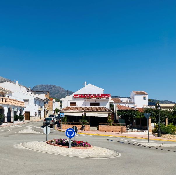
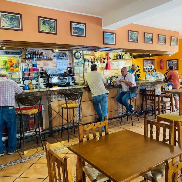
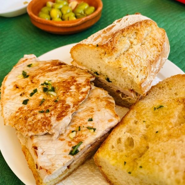
After the walk we visit one of the white villages. In Yunquera we visit Bar Quini. Here we order two drinks and two delicious lomo sandwiches. All in all € 8.50 together, including a lot of kindness. We would like to come back for this too, only with a little more time for a more extensive meal.
Thanks to Tomás Rueda for his help, biologo y coordinador de la Reserva de la Biosfera Sierra de las Nieves and responsible for the transition to the Parque Nacional.